|
 |
 |
|
|||
 |
 |
|
|
|||
|
|
||||||
| |
|
|
|
|
||
|
|
|
|
|
|
|
|
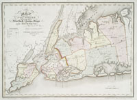
| Queens County
Queens County was settled by the Dutch in 1635, and title was obtained from the Rockaway Indians in 1639. Organized as a county by the English in 1683, Queens had earlier been the "North Riding" part of the larger Yorkshire District, incorporating Long Island, Staten Island, and part of Westchester County, established in 1665 for the purpose of holding court and establishing justice. Queens was named in honor of Catherine of Braganza, Queen of Charles II of England. Queens County was annexed by New York City in 1898. Three of its towns voted against joining New York, and those three, Hempstead, North Hempstead, and Oyster Bay, were joined to create Nassau County.
|
||