 |
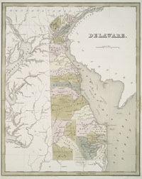
Delaware, 1838.
catalog
record
Virtually identical to the neighboring map on this page, this
map has been colored differently to highlight the “hundreds.”
The county names are inscribed on the map, but the coloring
obscures them almost completely.
|
Delaware is the second smallest state in the Union;
its breadth ranges from only 9 to 36 miles. The area was visited
in 1609 by Henry Hudson, in the service of the Dutch East India
Company, as he sought a water route west to Asia. In 1611, Thomas
West, Lord de la Warr, governor of Virginia, scoped out the region,
which was later named for him. Settled early on by Dutch and Swedish
colonizers, the area was in dispute for decades, but was eventually
purchased by the English and sold off to William Penn. Delaware
remained legally a part of Pennsylvania until 1776, but had long
claimed independence, and had its own legislature. In 1802, E. I.
DuPont established a gunpowder mill on the Brandywine River, the
beginning of the DuPont firm we know today.
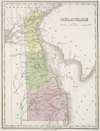 |
Delaware, 1824.
catalog
record
On this map, color differentiates the three counties of Delaware:
New Castle, Kent, and Sussex. The counties are further subdivided
into “hundreds,” which are colonial-era divisions
into districts that could theoretically supply 100 troops for
military activity when needed. |
|


