This website is part of The New York Public Library's Online Exhibition Archive. For current classes, programs, and exhibitions, please visit nypl.org.
American Shores Maps of the Middle Atlantic Region to 1850 The New York Public Library
Map Collection
Overview Basics of Maps Maps Through History Geographical Areas

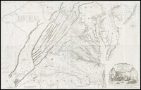
Virginia

Interestingly, Thomas Jefferson, his father Peter, and George Washington were all surveyors--thus providing the geographic foundation for Virginia and the expanding United States as well. Jefferson the surveyor made the bold move to purchase the Louisiana territory, and then proceeded to make sure it was explored and, yes, mapped. Jefferson's Lewis and Clark expedition had its roots in the Chesapeake country.

Virginia, 1755.
catalog record

This map was surveyed by Peter Jefferson, Thomas’s father, in 1775, in response to a request from the English Commissioners for Trade and Plantations for detailed maps from each colony. The map had early family and estate names, roads, and an early detailed mapping of the Appalachians. The cartouche at the lower right depicts a wealthy trader, happily smoking his pipe, as goods are being loaded by slaves onto a ship in the harbor. Another slave brings him a goblet of wine. Tobacco leaves fall out of a barrel, emblematic of the wealth created by this plant.

For more on the mapping of Virginia, see the Library of Virginia on-line exhibition.

To read more about the early mapping of Virginia, consult:

Virginia in maps : four centuries of settlement, growth, and development / edited by Richard W. Stephenson and Marianne M. McKee.Richmond : The Library of Virginia, 2000. catalog record


Privacy Policy | Rules and Regulations | Using the Internet | Website Terms and Conditions | © The New York Public Library