 |
 |
 |
|
|||
 |
 |
|
|
|||
|
|
||||||
| |
|
|
|
|
||
|
|
|
|
|
|
|
|
|
Nautical New York
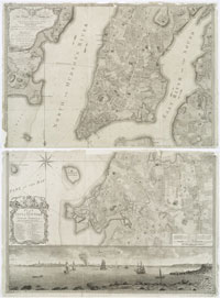
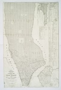
A protected harbor with deep river access to the interior of the continent made the success of New York a sure bet. The HarborNew York harbor is divided into its upper and lower harbor components by The Narrows, a slender water gate between Long Island (Brooklyn) and Staten Island. The huge protected harbor is home to some 40 islands, small and large. Over the decades many have been blasted away to aid navigation. Others, by way of landfill have become attached to nearby shores or doubled in size, as happened with Governor's Island. Access to the harbor is via The Narrows, Long Island Sound and the Hudson River, which is a tidal estuary up to Poughkeepsie. The early maps of the region, no matter how small or simple, reveal the water based economy and the acres of wetlands which are now decreasing as land-based progress erodes the once 500+ miles of natural shorelines. To read more about New York's harbor islands see: Sharon Seitz and Stuart Miller.
|
||||

