 |
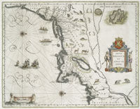
| Nova Belgica et
Anglia Nova., 1662.
catalog
record
Willem Blaeu's map of New Netherland,
right, with its westward orientation and population of notable
animals, is a delightful introduction to this new world open
for trade. This map is illustrated with Native American canoes
and two distinct palisaded villages, images probably copied
from Theodore De Bry's earlier published reports about America,
not from life. |
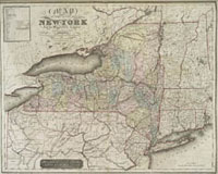
Named by Charles II after his brother, the Duke
of York, later James II of England, New York had been explored earlier
by the French and the Dutch, and their maps often reflect an interest
in the fur trade, and Native American contacts. Many of the early
maps on this website are invaluable for what they tell us obliquely
about the Native American presence on the land and contact with
the European settlers.
|