 |
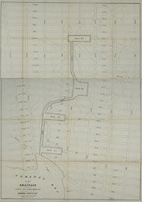
Gowanus Creek and Bay, 1848.
catalog
record
This map detailed the plans to control the water levels and
flooding potential of this wetland area in western Kings County,
now Brooklyn Borough. Faint lines show the original water courses
to be limited in the future to the canalized waterways. |
Gowanus Canal was created from Gowanus Creek,
on which stood two early tidal mills, Brower's Mill or Freeks Mill
and Denton's Mill. A critical portion of the Battle of Long Island
was fought near here, when the American General Stirling's troops
fought off Lord Cornwallis's redcoats long enough for General Washington's
successful retreat.
|


