|
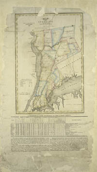
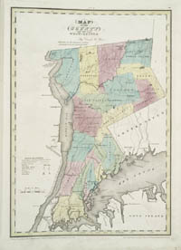
The Bronx Borough, home of the Yankees, was once
part of Westchester County. So early maps of the Bronx are not to
be found in library catalogs under B, but under Westchester. The
area of Westchester County west of the Bronx River, made up of the
towns of Morrisania, West Farms, and Kingsbridge, was annexed to
the City of New York in 1874. The eastern part, made up of the town
of Westchester and part of the town of Eastchester, was annexed
in 1895. The Bronx became a Borough of New York City in 1898, and
was named a County of New York State in 1914.
|