Part II: Settlement, Expansion, and the Business
of City Views
Latin American Cities
71
Cusco in West Indien
Etching, from Daniel Meisner, Sciographia Cosmica, published by Paulus
Fürst, 1637–42
Deák 6
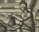 High
in the Andes lies Cuzco, the ancient capital of the Incan empire. Founded
around 1200 C.E., it was inhabited by rulers and nobility who lived in magnificent
palaces and temples. Its fabled wealth of gold attracted the Spanish conquistadors,
led by Francisco Pizarro in 1532. After deposing the leader Atahualpa, Pizarro
plundered and sacked the city. A colonial settlement soon sprang up on the
site, built on the foundations of the Incan city, and today it is one of the
oldest continuously inhabited cities in the Western world.
This view of Cuzco is based on an illustration in the first complete survey
of New World discoveries, published in Venice in 1556. The etching seen here
was included in an emblem book by Daniel Meisner, originally published in
the 1620s as the Political Treasure Chest, in which views of cities
from Europe to Africa, Asia, and the New World are juxtaposed with moralizing
and edifying verses about life in that part of the world. The emblem, a 16th-century
pictorial-poetical form, is composed of a brief verse or motto, an image,
and a lengthier, prose explanation. In this plate, “Nature is Thrifty,”
the “wild men” or native peoples are praised for their ingenuity:
lacking iron, they fell trees with fire and split logs with wooden wedges.
The small procession of figures in the background represents the deceased
leader Atahualpa being carried aloft to the High Temple.
72
Panama
Thomas Doesburgh (Dutch, active 1692–1714)
Etching, from Orbis habitabilis oppida et vestitus [Cities and
Costumes of the Inhabited World], published by Carel Allard, ca. 1700
Deák 59
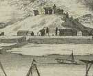 Panama
is one of the oldest European settlements in the Western world. Panama City
was founded in 1519 by Pedro Arias Dávila and quickly became a major
stop on the “Gold Road,” collecting the locally mined silver and
gold before its shipment to Europe. Repeatedly the target of pirates, buccaneers,
and the English, the city was destroyed in 1671 and rebuilt two years later,
recapturing much of its picturesque Spanish charm.
This engraving shows the city still in the early stages of reconstruction,
with few homes dotting the hillside. It was included in Carel Allard’s
publication of city and costume views, which was intended to provide a
pictorial
tour around the world (see also number 8).
73
Havana
Aldert Meyer (Dutch, b. 1663 or 1664)
Etching and engraving, from Orbis habitabilis oppida et vestitus
[Cities and Costumes of the Inhabited World], published by Carel
Allard, ca. 1700
Deák 58
 In
1492, Christopher Columbus arrived in the New World, landing at the Bahamas,
Haiti, and Cuba. Diego Velázquez arrived in 1515 at Havana, which served
as a base for the growing Spanish interests in the Caribbean and South America.
This strategic location led to constant attacks by those attempting to overthrow
Spain’s stronghold. The Morro Castle, built to prevent the invasion
of Sir Francis Drake, is seen in the center of this engraving.
The two elegantly attired figures add local color to the view and are a hallmark
of Allard’s publication. Two printmakers worked on this series; Thomas
Doesburgh etched the topographical views and Aldert Meyer produced the costume
plates.
74
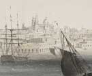
Montevideo vue prise du port
Jean-Louis Tirpenne (French, b. 1801), after H. Berthet (French, 19th century)
Color lithograph with hand-coloring, from Ports de mer d’Amérique,
printed and published by L. Turgis (Paris lithographic firm, 19th century),
1859
Deák 750
 Montevideo
was founded in 1726 by the governor of Buenos Aires in an attempt to limit
the advance of the Portuguese in the area. Its first settlers came from the
Canary Islands, and many others from throughout Spanish America soon flocked
there. In 1778 it became a free port and eventually one of the leading commercial
ports of South America.
French lithographer Jean-Louis Tirpenne captured this bustling waterside
in one of a series of views for Ports de mer d’Amérique,
which included such far-flung ports as Valparaiso, Chile, and San Francisco.
Tirpenne was a prolific lithographer, principally of landscapes: other artists
often supplied the figures in his prints. He was known as the author of “The
Tirpenne Method” which, as one contemporary noted, was referred to as
a “method for not learning how to draw.”
75
Vista de la ciudad de Lima desde las immediaciones de la Plaza de los
Toros
Etching and aquatint, ca. 1800
Deák 243
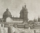 Francisco
Pizarro founded the colonial city of Lima in 1535, on the site of an ancient
urban center known as Pachacamac with origins as early as 200 B.C.E.
In Spanish-controlled South America, Lima was the major port for the shipment
of precious metals to Europe. A remnant of its early magnificent architecture,
most of which was destroyed in the earthquake of 1746, is seen on the far
left in the Church and Convent of San Francisco, founded in 1535. Women doing
their laundry on the banks of the Rimac River further enliven this cityscape.
76
Buenos Aires a vista de pajaro
D. Dulin (French, 19th century), after his own design
Tinted lithograph, printed by Julio Pelvilain (Argentinian lithographic firm,
19th century), ca. 1860
Deák 768
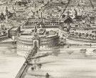 Argentina,
which declared its independence in 1816, was home to a cosmopolitan population
primarily from Spain and Italy, along with minorities from numerous other
European and South American countries. This vista de pajaro, or bird’s-eye
view, of the Argentinian capital suggests that prints of city views were produced
in South America in much the same spirit as those of North American towns
and cities. There, as in the United States, they could introduce newcomers
to the city while boosting the civic pride of current residents.
Note to the checklist. “Deák” refers
to the catalogue of American historical prints in the New York Public Library’s
collections: Deák, Gloria Gilda. Picturing America 1497-1899. Prints,
Maps, and Drawings bearing on the New World Discoveries and on the Development
of the Territory that is now the United States. 2 vols. Princeton: Princeton
University Press, 1988.
Next Section
