|
 |
|
| Photographic Services & Permissions |
 |
|
 Mapping
Muslim Kingdoms Mapping
Muslim Kingdoms
|
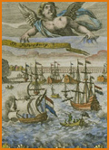
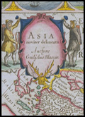
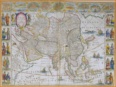
Joan Blaeu (15961673)
Grooten atlas, oft Werelt beschryving [The Great Atlas,
or, A Description of the World]
Amsterdam, 164864
NYPL, Map Division
This Dutch map of the Asian continent, centered on West Asia, suggests the exoticism
of these regions, as well as neighboring Muscovite Russia. Central Asia is typified
by a camel; India by an elephant. Square-rigged galleons sail the Indian Ocean
and the Arabian Sea; a whale spouts at top right. The outer margins present vividly
hand-colored costume drawings of Muscovites, Tatars, and others.

|
|