|
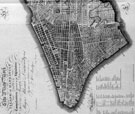
Humanities and Social Sciences Library > Collections & Reading Rooms > Print Collection > MOVING UPTOWN INTRODUCTION The city grew swiftly up the island, with the affluent usually leading the migration, settling ahead of the centers of business, trade, and industry. As the century progressed, the well-to-do, and to a lesser degree the middle class, also distanced themselves from growing pockets of poverty, primarily south of 14th Street and near the waterfront, home to immigrants, first from England, Ireland, and Germany and later from Italy, Russia and Eastern Europe. Early in the century new citizens enjoyed considerable social and economic mobility, class distinctions were subtle, and wealth was modestly displayed, but by mid-century, when immigrants outnumbered the native-born, New York was notable for conspicuous contrasts of great affluence and great poverty. Though poverty and crime were troublesome, the overriding spirit of the city was optimistic. The leading financial, business, and manufacturing center of the country, the city had a glorious future. As a writer predicted in 1827, "we shall, at the close of the present century, not only equal but far surpass either of the great cities of London or Paris in population, trade, commerce, navigation, arts, science." Moving Uptown traces Manhattan's urban evolution as it has been recorded in 19th-century prints, drawn primarily from the Eno Collection of New York City Views and the I. N. Phelps Stokes Collection of American Historical Prints, both gifts to the Library's Print Collection of the Miriam and Ira D. Wallach Division of Art, Prints and Photographs. These views rarely dwell on any of the disturbing social repercussions of the city's remarkable growth (that was primarily the purview of illustrated journals), but rather they celebrate the ever-changing face of a thriving, bustling, confident city. This exhibition has been made possible through the generous support of Miriam and Ira D. Wallach. |