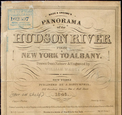
TRAVEL ALONG THE HUDSON
In 1845, New York engraver William Wade created
a ten-foot long panorama illustrating both sides of the
Hudson River between Albany and New York City. The following
year this remarkably detailed pictorial record was published
as a pocket-sized folding map. Sold in plain and colored
versions, the panorama aided travelers in identifying
natural features, landings and architectural landmarks
along the 138-mile route.
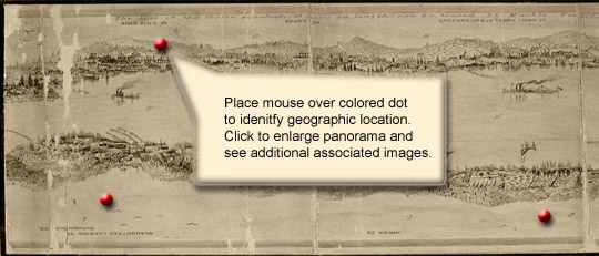
Begin your travels
now
View Wade's Panorama in Quicktime format
(requires high speed connection)
looking east looking
west
View
Catalog Record