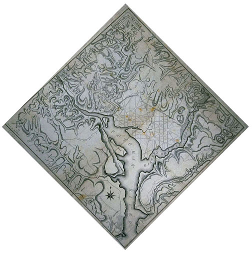
Photographic Services & Permissions Andrew Ellicott Meant to be displayed like a diamond, with the label "Territory of Columbia" at the top, this map is of the "ten mile square" that Liancourt talks about in his Travels, in the case to the left. The focus here is on carefully identifying the area for the new national capital, which, after much political haggling, had been selected by President George Washington, and set aside by Congress in 1790 and 1791. Ellicott has carefully surveyed the boundaries, setting up mile markers all around, and noting on the map the topography and important roads already extant. There is very little text on the map, but Ellicott does draw the city boundary inside the ten-mile-square district, and sketches in architect Pierre Charles L'Enfant's (slightly modified) proposed main thoroughfares: "Out Lines of the City of Washington with the grand Avenues and principal Streets leading through the public appropriations." The President's House (White House) and Capitol are located; construction had begun on them in 1792 and 1793, respectively. Of course, today, the city of Washington and the District are coextensive. The Virginia portion of the territory was later returned to that state, and is now Arlington. |