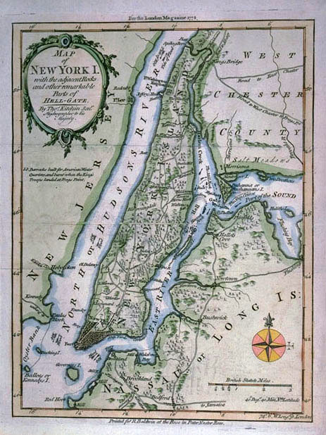
Photographic Services & Permissions Thomas Kitchen, Sr. The English city of New York has moved north toward what is now City Hall Park, with a burst of population up the Bowery, then a major highway leading toward the Eastern or Boston Post Road. During the entire period of the American Revolution, New York was occupied by British troops. Hell-Gate is a focus of this little map, with its arrows pointing out the circuitous "ship course" for safe passage. Adrian Block, the Dutch explorer, named this site Helegat or Hell-Gate when he sailed his Tyger through it in 1612. Thousands of vessels were lost in its seething, eddying tidal currents, generated by a ledge of rocks projecting into the water from Long Island. Originally issued in black and white in the popular coffee house journal The London Magazine in March 1778, this map now sports 20th-century color. The London Magazine was one of several monthly periodicals, published in the thousands and distributed throughout England, that reported on popular topics, including war in America. This map, for example, pinpoints military encampments in upper Manhattan. |