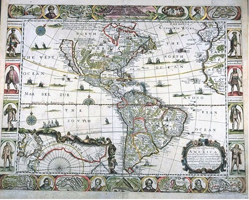
 Photographic Services & Permissions John Overton This colorful, busy map is among the earliest maps of the Americas in English. Very much copied after Dutch maps, it is comparable to the similar, but more beautiful Willem Blaeu map of the Americas in Section II of this exhibit. At the top and bottom borders are to be found explorers' portraits and mini-maps of important sites: Mexico City, Cusco, Carolina coast, Potosi. These were iconic cities, which appeared over and over on maps of the "New World." At the right and left margins are representations of different Native American groups. The map itself is covered with place names, and in the New York area, New Netherland is named. This is a surprise on an English map, as New Amsterdam had been taken from the Dutch by the English, and renamed New York in 1664. This may reflect careless reliance on an earlier Dutch map as a model. |