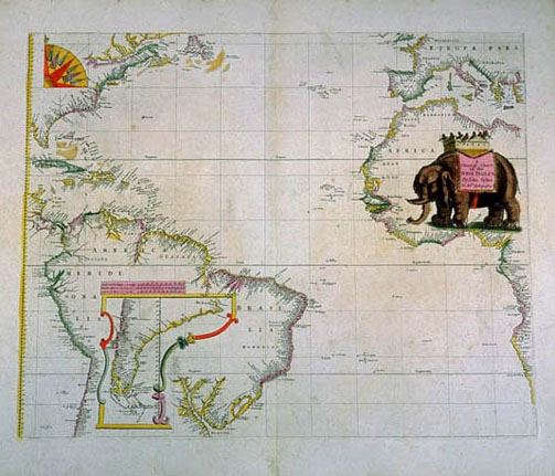
Photographic Services & Permissions John Seller Jonathan Swift says in the adjacent poem much that needs to be said about this chart of the Atlantic world. Taken from Seller's Atlas Maritimus, it is, despite that nautical appellation, without soundings or rhumblines. This is a plane chart, with latitude notations given in equidistant measure, with no allowance for curvature of the earth near the poles, as is made in a Mercator projection. Longitude measurement was still very uncertain in 1675 - these vertical lines are left over from an erased circular rhumbline grid (see Gerard Van Keulen's sea chart on a nearby wall) and are not timelines, or meridians, based from a prime meridian at Greenwich or Ferro. |
Return to Part III Images | Return to Exhibit | Return to Checklist
Exhibition Home Page | Table of Contents
EPO, 1998